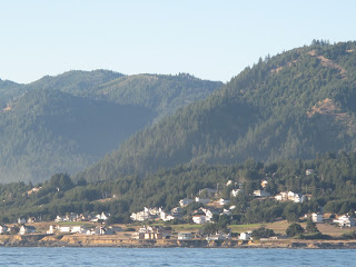
 |
| Town of Shelter Cove |
We left Eureka at 6:30 am on Sunday, September 16th and motored 60 miles to Shelter Cove, arriving at 6:45 pm. The community of Shelter Cove is in an area referred to as “California’s Lost Coast” because it is isolated from Highway 101 by a 26-mile narrow and winding road. The weather was warm and settled and the gentle swell lulled us into staying another day although we didn’t go off the boat.
 | |||||||||||
| Sunset at Shelter Cove |
We did, however, pick up the biggest swarm of titanium flies so far on the trip prompting us to put the screens on the hatches and launch an all-out killing spree inside the cabin. We enjoyed a nice sunset on our second evening there and in the morning as we left there was an interesting mist on the water. We motored 37 miles to Fort Bragg where we tied up at a small private dock at the Carine Restaurant.
 |
| Mist in the morning |
Fort Bragg
 |
| Highway 101 bridge into Fort Bragg |
We were looking to spend a few days in Fort Bragg to hide out from some bad weather coming along but the marina was full. They had also lost some slips to the tsunami earlier in the year reducing the available accommodations. The marina manager went out of his way to find us this place to tie up.
 |
| Three Hour Tour going under the bridge |
 |
| Docked at the Carine Restaurant |
 |
| Coast Guard Station and marina |
Fort Bragg is mainly a fishing harbour with seafood markets, shops and restaurants along the banks of the Noyo River. We were moored almost directly across from the Coast Guard station and we watched them go out on their bar checks each day (no matter what the weather) and do things like docking practice. We confirmed that the grocery store is always uphill.
 |
| Unknown flowers |
We took the dingy upriver one afternoon to see what there was to see. I could tell that we were getting far from home because there were lots of trees, both coniferous and deciduous, and plants that I had never seen before. There were sea lions up to a mile upriver and way up, maybe five miles, where the river had grown narrow and overhung by branches, I saw fish rising and was wishing for my fly rod.
Here’s a little video clip of the bad weather we were waiting out.
We left Fort Bragg at 7:45 am on September 23rd in fog and motored overnight to Spud Point Marina at Bodega Bay, arriving at 9:00 am on Saturday, September 24th.
Bodega Bay
 |
| Blowdega Bay |
Bodega Bay is another major commercial fishing center and most of the boats in the marina were trollers. It is off the highway and is a sleepy little town with a couple of small grocery stores for the marina and RV park. The locals call it Blowdega Bay because the wind always comes up in the afternoon. Other than doing some laundry and walking to the store a couple of times, I can’t figure out what we did for three days. The laundromat had a nice little exchange library where I traded out some of the books I’d read for some new ones.
At many of the towns along the Oregon and so far, the California coast, the most beautiful pampas grass grows voluntarily at the side of the road. Also, for some reason, dill! I picked a branch of dill and brought it onboard only to find out later it was covered in aphids. I gave that the heave-ho pretty quickly.
 |
| Bodega Bay |
From this picture of part of the town of Bodega Bay you can see how dry the hills are. It hadn't rained here since April. This was typical of the landscape for much of the coast of California. Sort of like Kamloops.
We left Bodega Bay on Wednesday, September 28 and actually sailed most of the way to Drake`s Bay, 25 miles away where we anchored for the night.

Merry Christmas Mark & Birgit!
ReplyDeleteThinking of you at this festive time and trust all is well with the two of you. Give a shout when you can.
Love Kevin & Darcy